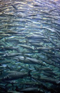
 An ecosystem is represented by several groups of species linked together by trophic relationships. For example, the dolphin feeds mainly on small pelagic fish, small pelagic fish on zooplankton and zooplankton on phytoplankton. If there is a change at one level of the ecosystem (for example, under the effect of climate or anthropogenic pressure), cascading effects will be observed on the lower and/or higher trophic levels.
In the Bay of Biscay, we find:
- an increase in surface temperatures of 0.3°C since 2000 as a result of climate change;
- an increase in anchovy biomass since 2010;
- an increase in dolphin strandings since 2010.
The challenge is to provide new knowledge on the habitats and distributions of small pelagic fish and common dolphins. Their evolution over time will be characterized and 3D maps of small pelagic fish and their level of aggregation over the seasons will be produced. Subsequently the co-occurrence between small pelagic fish and common dolphins in their different seasonal habitats will be modeled.
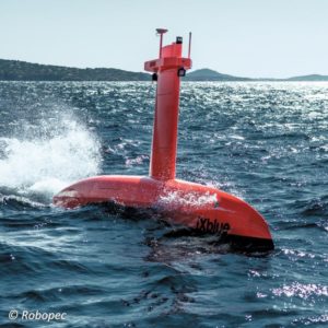
This will be possible thanks to the use of existing data on the subject, data from WP1, and thanks to sea campaigns using marine drones equiped with echo sounders and hydrophones, and aerial surveys.
Evolution of the habitats of dolphin and small pelagic fish in the Bay of Biscay
This task will mainly use satellite data to build time series and characterize plankton forcing variables. The objective is to test whether changes observed at low trophic levels (plankton) affect higher levels.
Cartography 3D and aggregation level of small pelagic fish according to seasons in the Bay of Biscay
 There is a lot of data on small pelagic fish in spring and autumn thanks to scientific campaigns (eg PELGAS or EHVOE) but summer and winter are much less known. In winter, the data is almost non-existent, which is problematic because dolphin strandings mainly occur during this period.
Information from fishing campaigns and landings, data from a pilot campaign using autonomous drones (equipped with echo sounders and hydrophones), combined with aerial surveys (WP1), will be compiled. This task aims to produce a 3D map of small pelagic fish in different seasons, to investigate their aggregation levels and to link with the common dolphins distribution.
Statistic modelisation of co-occurence between small pelagic fish and common dolphin in their different seasonal habitat
This last task aims to integrate all the knowledge produced previously via a statistical model to predict the distribution of dolphins. This model will be forced with hydrological, physical and oceanographic variables, and will integrate information obtained during aerial surveys (WP1).
 An ecosystem is represented by several groups of species linked together by trophic relationships. For example, the dolphin feeds mainly on small pelagic fish, small pelagic fish on zooplankton and zooplankton on phytoplankton. If there is a change at one level of the ecosystem (for example, under the effect of climate or anthropogenic pressure), cascading effects will be observed on the lower and/or higher trophic levels.
